
Hellweek Gear Test 2
Second gear test, got everything working the way I want this time.
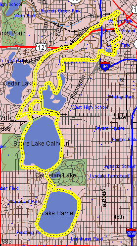
Below you can see the ride that I took, total distance of 15.9 miles:
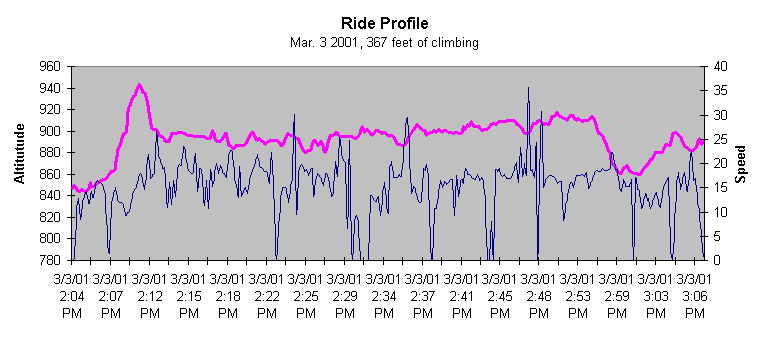
Here is an elevation profile of the ride. I was also able to put speed on here as well, the GPS tracks the distance from each sampling point and the time difference, from that you can derive you speed at any point of your ride.
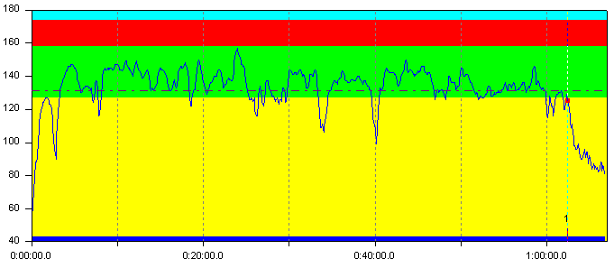
Last but not least is the all important heart rate graph. I may experiment with exporting this and putting it on the same ride profile chart above, it would correlate more directly with climbing and speed anyway.
Part of the Texas Hellweek 2001 collection.