
Hellweek Gear Test 1
Took my GPS on my ride with me to do a gear test before heading to Texas. Had the heart rate monitor on as well, but for some reason I got no signal, not sure what the problem was with that.
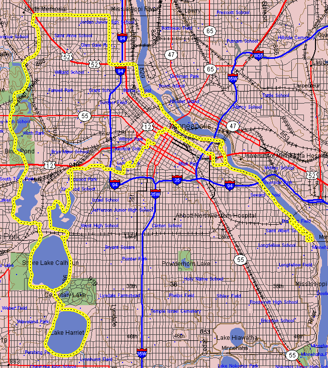
Below you can see the ride that I took today, total distance of 29.8 miles:
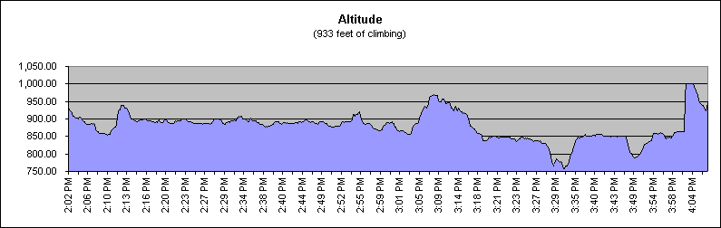
Here is an elevation profile of the ride. This was good as the vertical climbing per mile is similar to what I’m expecting in Texas:
Part of the Texas Hellweek 2001 collection.