
Our Neighborhood in 1938
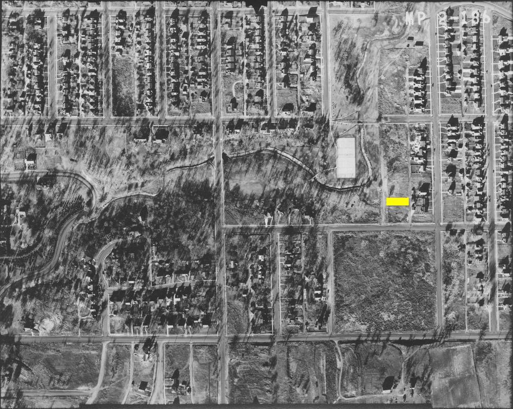
My friend Garrick shared this link to the Minnesota Historical Aerial Photographs Online site. It is a pretty cool site where you can see aerial photos all over Minnesota going back as far as 1920. I immediately went and looked where we live and they currently only have one photo from 1938. I’ve highlighted our lot in yellow.
It was surprising to me that the tennis courts were in place back then. In fact, the entire Minnehaha Creek West Park seems to be pretty much as it is now with the same walking bridges and everything.
Our street doesn’t exist yet. The entire row of houses that we live in are not there but the other side of the block has been developed. Our house was built the following year, in 1939.
I also pulled up our previous house in Minnetonka in 1937 and it was entirely farmland. Was still farmland in 1956. The transformation there is amazing.